Lyon Metro

Written by James M. Young

Updated 15th January 2024
Background

Location Lyon, France
First line opened 1978
Last major update 2023

Open lines 4

Open stations 42
Lyon is situated in south-east France. The first 3 lines on the network all opened in 1978. The 4th line opened in 1991. The network carried 212 million passengers in 2018.
Line A
Line colour Pink
Opened 1978
Stations 14
The first part of Line A opened on 2nd May 1978 between Perrache and Laurent Bonnevay Astroballe. This was extended from Laurent Bonnevay Astroballe to Vaulx-en-Velin La Soie on 2nd October 2007. The line was constructed using the cut-and-cover method. Line A uses MPL 75 rolling stock, trains are powered by a third rail. Trains run on rubber tyres instead of steel wheels.
Gallery
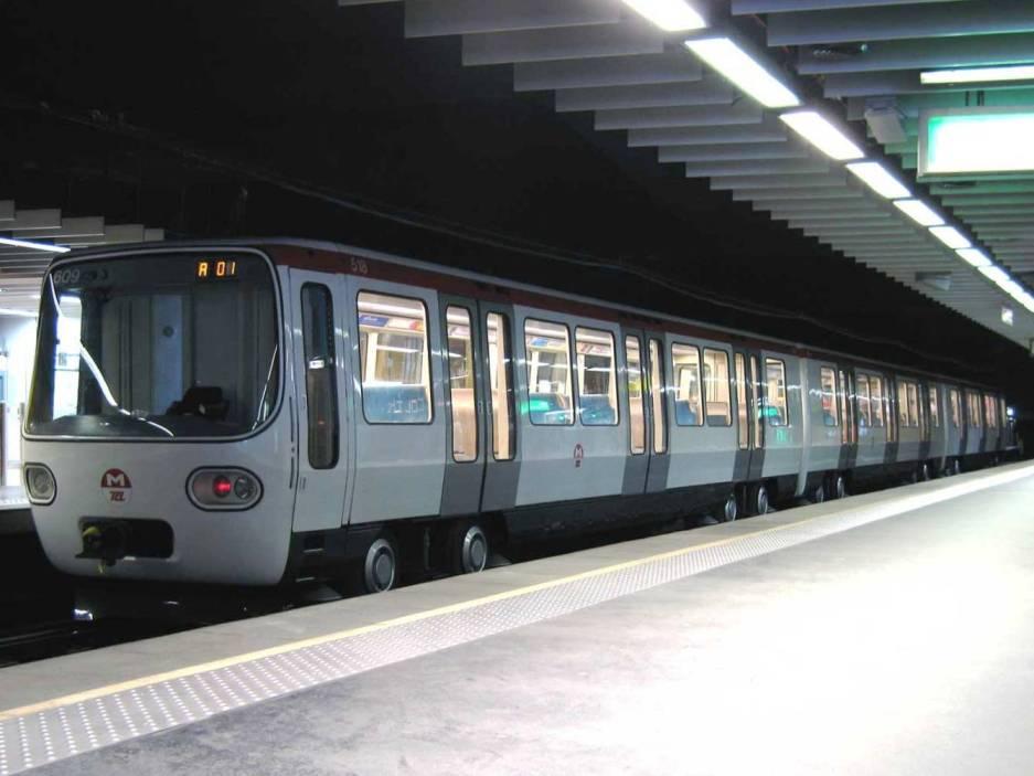 MPL 75 stock train at Perrache station in 2006. Photo by Rame
- MPL 75 stock train at Perrache station in 2006. Photo by Rame
Line B
Line colour Blue
Opened 1978
Stations 12
The first part of Line B opened on 2nd May 1978 between Charpennes - Charles Hernu and Gare Part-Dieu - Vivier Merle. The line was then extended as follows:
- Gare Part-Dieu - Vivier Merle to Jean Macé opened on 14th September 1981.
- Jean Macé to Stade de Gerland opened on 4th September 2000.
- Stade de Gerland to Gare d'Oullins opened on 11th December 2013.
- Gare d'Oullins to Saint-Genis-Laval - Hôpital Lyon Sud opened on 20th October 2023.
The line was constructed using the cut-and-cover method. Line B used MPL 75 rolling stock until June 2022 when the line was changed over to MPL 16 trains, which uses a fully automated system similar to Line D. Trains are powered by a third rail. Trains run on rubber tyres instead of steel wheels.
Gallery
 MPL 16 stock train at Oullins Centre station on 20th October 2023. Photo by Arthuur782/2
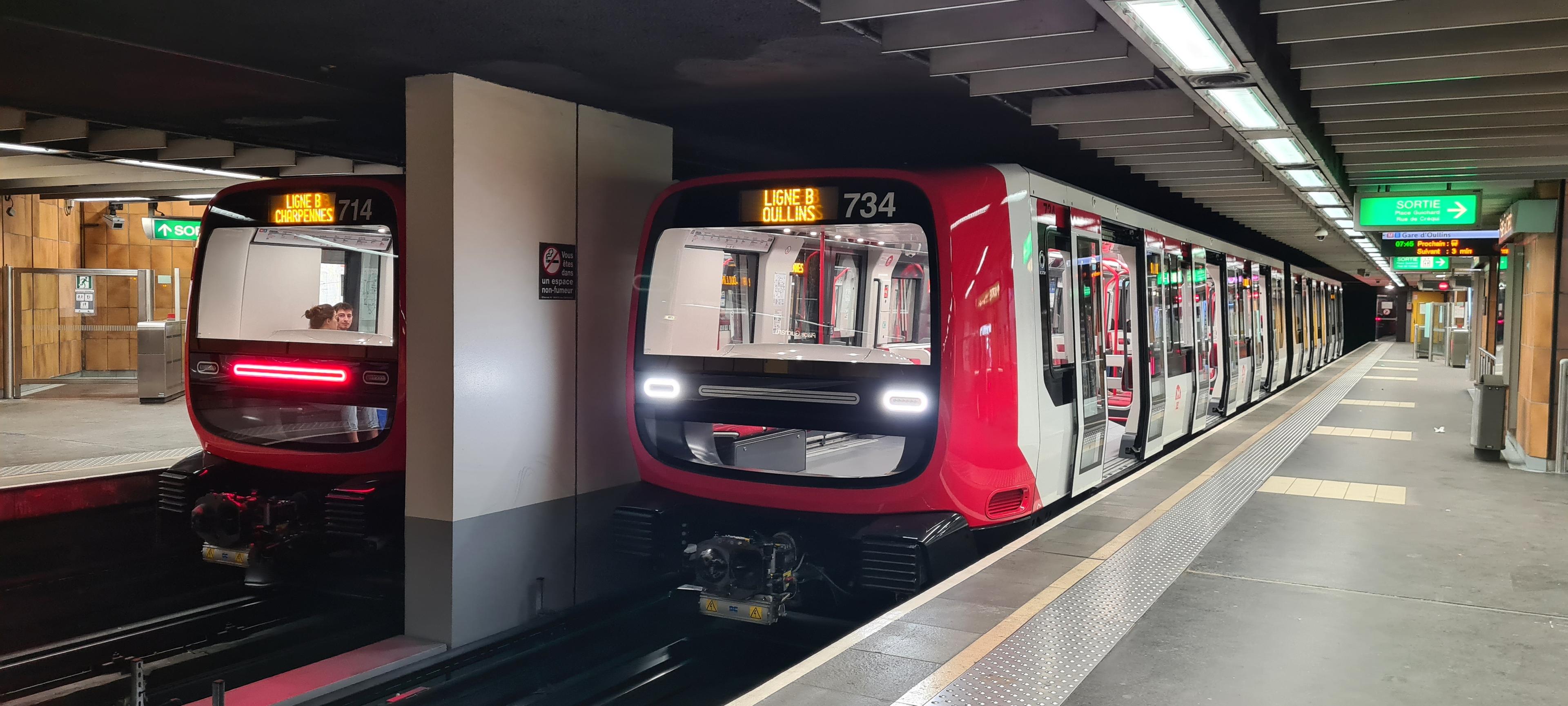 MPL 16 stock trains at Place Guichard - Bourse du Travail station in 2022. Photo by Florian Fèvre1/2
- MPL 16 stock train at Oullins Centre station on 20th October 2023. Photo by Arthuur782/2
- MPL 16 stock trains at Place Guichard - Bourse du Travail station in 2022. Photo by Florian Fèvre1/2
Line C
Line colour Orange
Opened 1978
Stations 5
Line C is the only line that predates the metro. The original part opened as a funicular railway in 1891 between Croix-Rousse and Croix-Paquet. The line closed in 1972 to be converted to a rack railway, reopening on 9th December 1974.
On 2nd May 1978 in became part of the new metro, this included an extension from Croix-Paquet to Hôtel de Ville - Louis Pradel for connection to Line A. The line was also extended from Croix-Rousse to Cuire on 10th December 1984. The line was constructed using a mixture of cut-and-cover and tunnels, with some parts being on the surface. Line C uses MPL 80 rolling stock, trains are powered by overhead lines.
Croix-Paquet lays claim to being the steepest metro station in the world, with an include of 17%.
Gallery
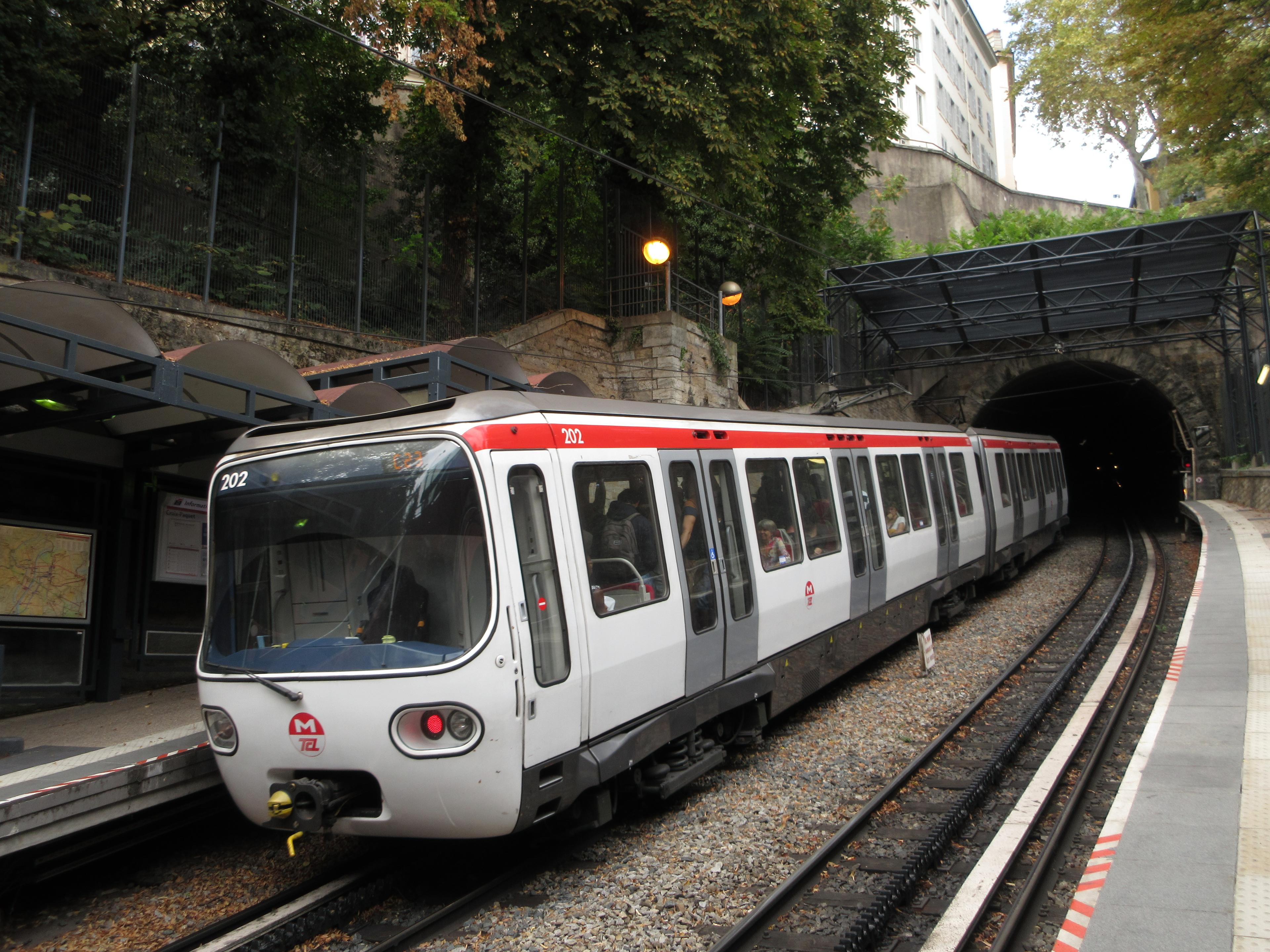 MPL 80 stock train at Croix-Paquet station in 2005. Photo by Robert Will
- MPL 80 stock train at Croix-Paquet station in 2005. Photo by Robert Will
Line D
Line colour Green
Opened 1991
Stations 15
Line D was the first fully automated metro line in France. The first part of the line opened between Gorge de Loup and Grange Blanche on 9th September 1991. This was extended from Grange Blanche to Gare de Vénissieux on 11th December 1992. The final extension opened on 28th April 1997 between Gorge de Loup and Gare de Vaise. The line was constructed using tunnel boring machines. Line D uses MPL 85 rolling stock, trains are powered by a third rail. Trains run on rubber tyres instead of steel wheels. The line is currently being updated with a new automated system, once complete it will use the new MPL 16 rolling stock, the same as Line B.
Gallery
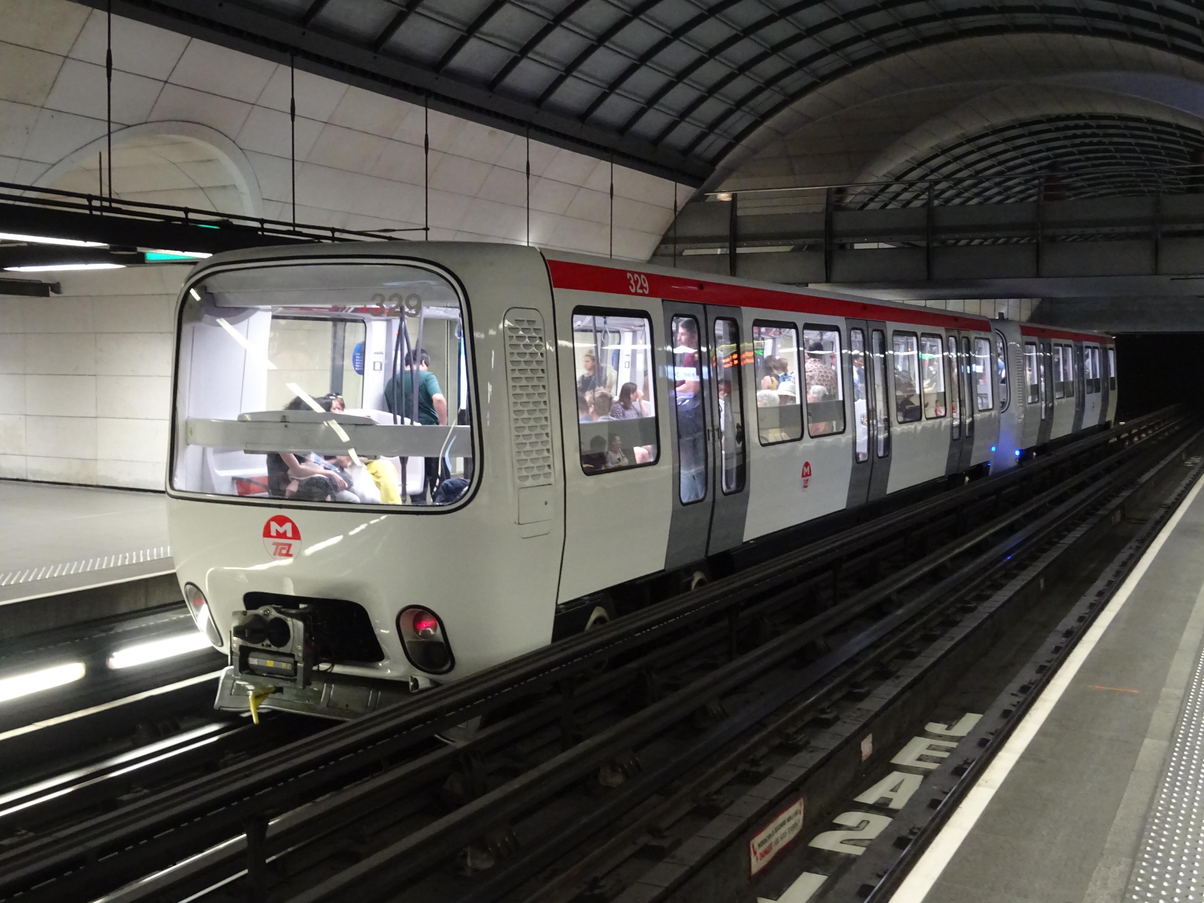 MPL 85 stock train at Vieux Lyon - Cathédrale Saint-Jean station in 2019. Photo by Remontees
- MPL 85 stock train at Vieux Lyon - Cathédrale Saint-Jean station in 2019. Photo by Remontees
Future
There are no fixed plans for any additional extensions or lines at present. There was the possibility of a further line in the west of the city, but this has been cancelled in favour of an express tramway.
Enjoyed this content? Share it with your friends!
More maps to discover

Driverless metro in Copenhagen, Denmark
The oldest underground railway in the world

Light rail network serving Newcastle and Sunderland


Disclaimer
Please note the map is for display purposes only. This should only be used as a guide on how the network has changed over time and not as a travel tool. Please see each networks's official website for an up-to-date map for travelling around that city.
Map design is loosely based on the original concept by Harry Beck for London Underground.
Some things to note about maps:
- Only shows passenger lines.
- Does not show different services on lines.
- Shows the companies who ran services over lines, not who owned them.
- Only shows how lines intersect and in no way represents where stations are in real life, either geographically or by distance.
- Only shows stations as intersections if you can walk between lines without leaving the station(s).
- Only shows changes between years. If a station closed and opened in the same year this will not be shown etc.
- Does not show interchanges between other travel networks.
Images are copyright to their respective owners.
If you spot anything that is wrong, have suggestions or comments or suitable photos for a network, then please get in touch on our contact page.