Glasgow Subway

Written by James M. Young

Updated 7th March 2023
Background

Location Glasgow, United Kingdom
Opened 1896
Refurbished 1980

Stations 15
Glasgow in Scotland lays claim to having the third-oldest underground railway in Europe.
The subway has a single loop line with a pair of tracks, so you travel either way round the loop. It serves the centre of Glasgow, crossing the river Clyde twice and having connections with the mainline stations in the city, albeit most requiring a short walk. The network has 15 stations.
Construction on the subway began in 1891 by the Glasgow District Subway Company. The subway opened on 14th December 1896 and operated trains using a clutch-and-cable system. This meant in effect the clockwise and counter-clockwise loops ran as separate lines with no way to change between each. For servicing trains had to be craned out near Govan station. In 1935 trains were changed to be powered by a third rail.
On 21st May 1977 the whole subway was closed for refurbishment works. This included closing Merkland Street station and replacing it with a new station nearby, Partick, for better connections with the mainline station. The subway reopened on 16th April 1980.
Rolling stock
The network has had 3 generations of trains. The first generation entered service when the subway opened and were only withdrawn when the network was closed for refurbishment in 1977. The second generation entered service in 1980 and are currently still being used. The third generation set of trains are currently being built in Switzerland and should enter service in 2023.
Gallery
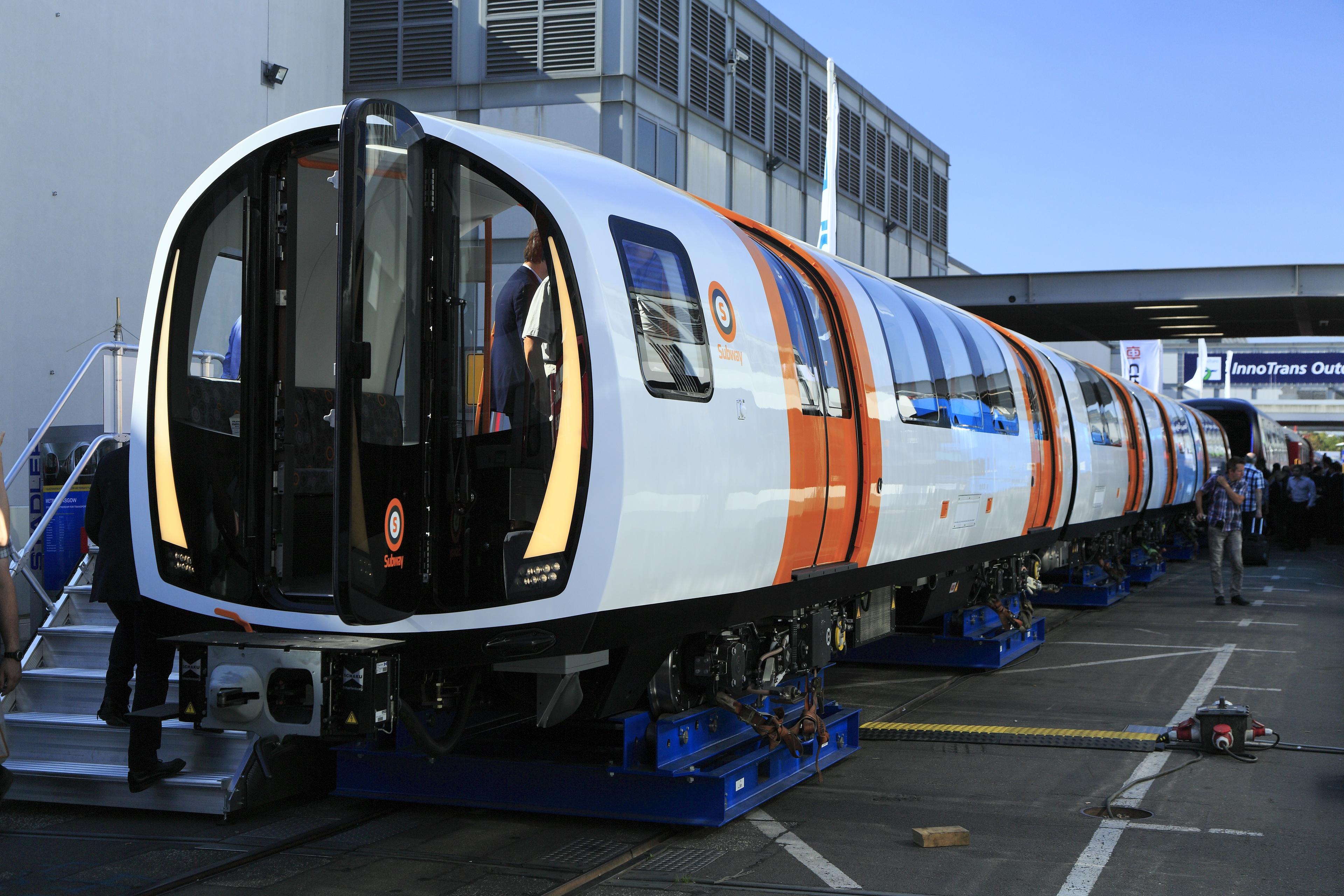 Third generation train outside Switzerland factory in 2018. Photo by Falk24/4
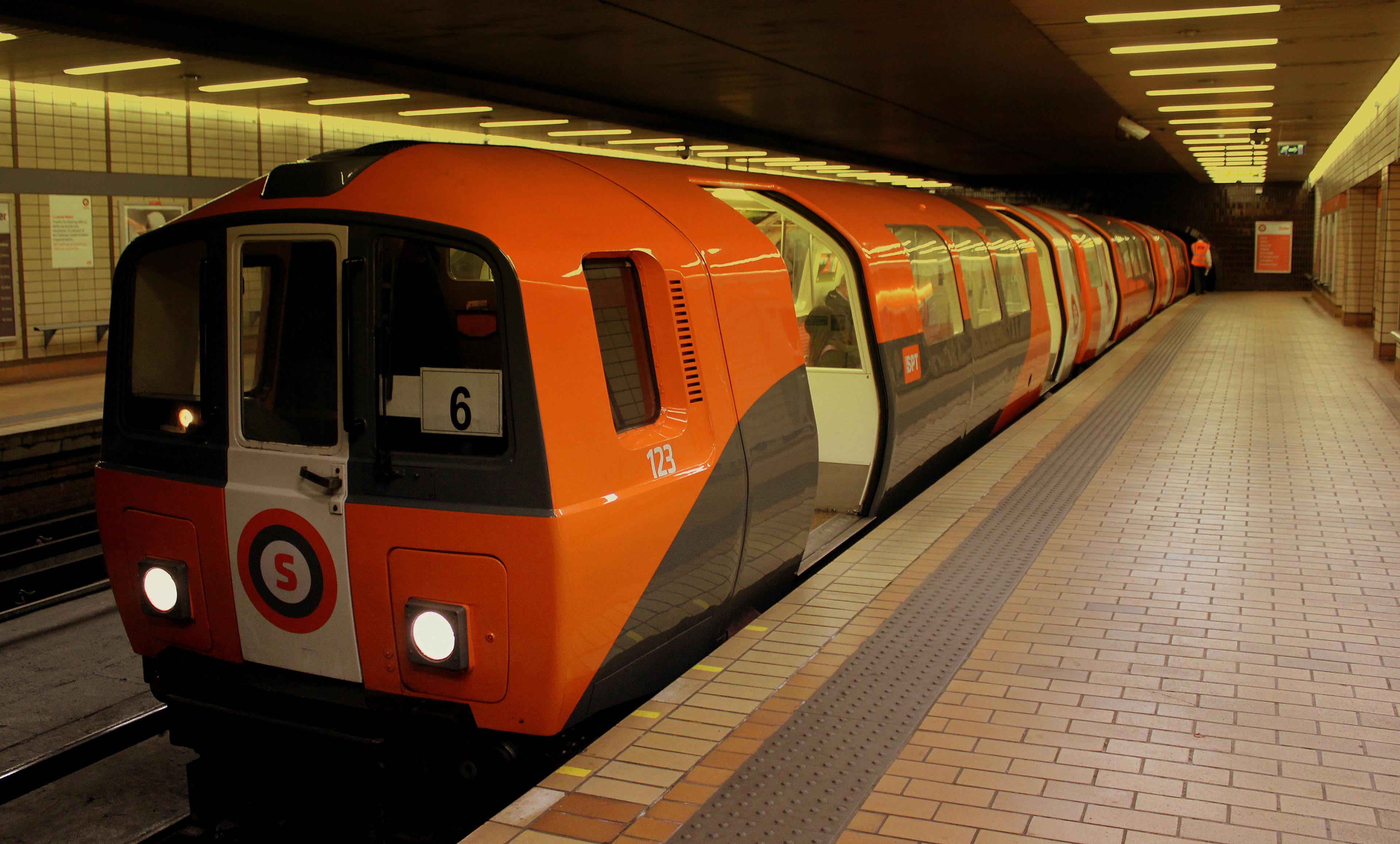 Second generation train at Buchanan Street station in 2013. Photo by calflier0011/4
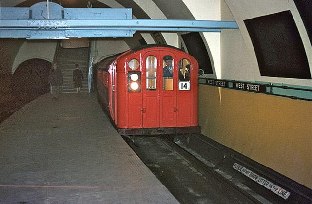 First generation train at West Street station on 24th March 1966. Photo by Alan Murray-Rust2/4
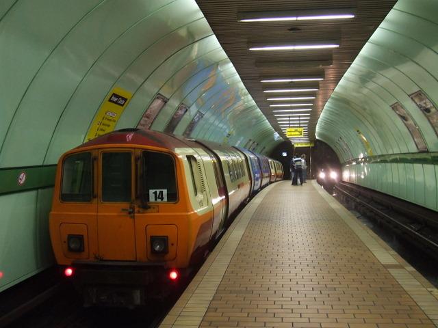 Second generation train at Cowcaddens station in 2008. Photo by Thomas Nugent3/4
- Third generation train outside Switzerland factory in 2018. Photo by Falk24/4
- Second generation train at Buchanan Street station in 2013. Photo by calflier0011/4
Future
The Glasgow Subway is not only one of the oldest subways but is also the only one to not have been extended since it was first built. There have been many suggestions for extending the network in each direction, possibly using existing abandoned tunnels, but these have not come to anything so far. As of now there are no firm plans to extend the subway in the near future.
Enjoyed this content? Share it with your friends!
More maps to discover

Driverless metro in Copenhagen, Denmark

4 line metro in south-east France
The oldest underground railway in the world


Disclaimer
Please note the map is for display purposes only. This should only be used as a guide on how the network has changed over time and not as a travel tool. Please see each networks's official website for an up-to-date map for travelling around that city.
Map design is loosely based on the original concept by Harry Beck for London Underground.
Some things to note about maps:
- Only shows passenger lines.
- Does not show different services on lines.
- Shows the companies who ran services over lines, not who owned them.
- Only shows how lines intersect and in no way represents where stations are in real life, either geographically or by distance.
- Only shows stations as intersections if you can walk between lines without leaving the station(s).
- Only shows changes between years. If a station closed and opened in the same year this will not be shown etc.
- Does not show interchanges between other travel networks.
Images are copyright to their respective owners.
If you spot anything that is wrong, have suggestions or comments or suitable photos for a network, then please get in touch on our contact page.